Import Heightmap
Import a heightmap and an optional texture to create a terrain.
Table of contents
Overview
Heightmaps can be generated with terrain generators like the freeware tool Terragen. But you can use basically any image to get some interesting results.
The heightmap is typically a black and white image. This image tells the algorithm how high a certain part of the landscape is. The brighter a pixel, the higher the terrain is at that point. By setting a max height you tell the algorithm how high a voxel will be if a pixel is pure white.
Qubicle allows you to pick a second image that needs to be the same size as the heightmap. That image will be mapped on top of the generated terrain as a texture.
How to Import a Heightmap
- Choose
File > Import Heightmap - Adjust import options
Import Options
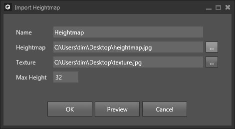
| Option | Description |
|---|---|
Name | Sets the name of the resulting matrix. |
Heightmap | Sets the image used as heightmap. |
Texture | (optional) Sets the image used as texture. |
Max Height | Sets the height of the resulting matrix and the elevation used for a white pixel of the heightmap. |
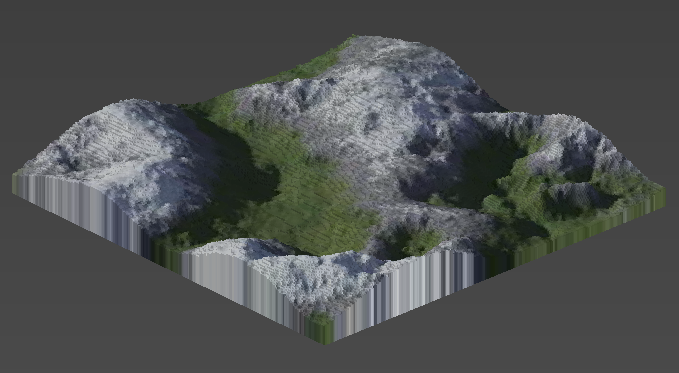
Example
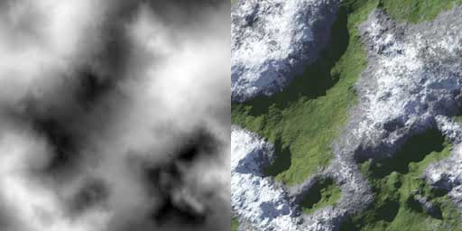
Using the two images above as heightmap/texture and a max height of 32 will output the following terrain: